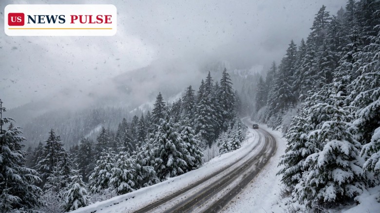
A Western US winter storm is bringing the first significant snow of the season to the mountains of the Pacific Northwest and the Northern Rockies, with favoured ski resorts forecast to receive 6 to 14 inches over five days before Halloween. The system, the second in a quick one-two punch across the region this week, arrived stronger and slower-moving on Tuesday night, October 27, pushing heavy snow into British Columbia and the Washington Cascades and dropping snow levels toward the bases of many resorts. Winter is arriving early in the West, even as lower-elevation towns nearby are likely to see rain or far less snow.
According to OpenSnow, the pattern changed decisively this week as cold air and moisture moved into the Northwest. The first storm hit Oregon early on Monday, October 26, bringing snow to Mt. Bachelor and mixed precipitation to other ski areas, before swinging across the Northern Rockies on Monday night with snow for Jackson Hole and Big Sky. The second storm then took over, and forecasters describe it as the more important of the two for the Cascades and the Inland Northwest.
On Tuesday night, heavy snow developed across British Columbia and the Washington Cascades as colder air arrived and snow levels fell to the bases of many resorts. On Wednesday, October 28, the storm continues across British Columbia, Washington and northern Oregon, including the Mt. Hood area, while heavy snow also develops farther inland. OpenSnow names Schweitzer in Idaho and Whitefish in Montana among the areas positioned for accumulating snow, along with the BC Powder Highway and the Canadian Rockies.
That inland push separates this system from a purely coastal event. By Thursday, October 29, a low-pressure area off the Pacific Northwest coast gradually shifts southward, with lingering moisture still bringing additional snow showers.
Early-season storms in late October often set the tone for the ski season without deciding it. A 6- to 14-inch fall at favoured resorts is significant because it can build a base on upper slopes, fill in early-season terrain and give snowmaking crews colder air to work with. It does not, by itself, mean that a resort is ready to open, and OpenSnow's own outlook makes that distinction: snowfall is an encouraging early-season signal, but it does not necessarily mean resorts are ready to open.
The geography explains why totals vary so much. The Cascades catch moist Pacific air first; the Northern Rockies, including parts of Idaho and Montana, benefit when a storm moves through rather than stalling offshore; and British Columbia's Powder Highway corridor is similarly favoured. The 6- to 14-inch range means those favoured resort locations over five days, not a blanket total across entire states.
Elevation is the other key variable. As colder air arrives, snow levels drop to the bases of many resorts. Above that line, snow accumulates; below it, the same system may fall as rain or melt quickly.
Halloween weekend brings more people onto mountain roads, and the next system is already on the horizon. From Friday, October 30, OpenSnow expects the storm track to shift toward California and the Southwest, with possible mountain snow in the Sierra Nevada and the Southern and Central Rockies. The extended outlook points to above-average precipitation and colder temperatures from Halloween into early November, while Central and Eastern North America stay comparatively warmer and drier.
The heaviest snow in this Western US winter storm is concentrated where moist Pacific air, cold air and mountain lift meet. In the Cascades, that means Washington and northern Oregon, including the Mt. Hood area, on Wednesday. In British Columbia, it means the Powder Highway resorts and the Canadian Rockies. Farther inland, Schweitzer Mountain in Idaho and Whitefish Mountain Resort in Montana are named as the Inland Northwest areas best positioned for accumulating snow on Wednesday.
Resorts that saw snow from Monday's first storm, including Jackson Hole and Big Sky, are also part of the wider five-day picture, though the second storm's heaviest focus is farther west and north. Read the range as a resort-by-resort forecast: some favoured slopes will reach the top, others will sit near the bottom, and lower elevations will see less.
For drivers, expect winter conditions on mountain passes even when valley towns look mild: snow, reduced visibility and slick surfaces can appear quickly when a snow level drops. Check the forecast for the specific pass, not a city forecast, through Wednesday and into Halloween weekend.
OpenSnow meteorologist Alan Smith describes the incoming system as "stronger and slower-moving" than the first storm of the week, with "heavy snow developing across British Columbia and the Washington Cascades on Tuesday night."
Forecasters also stress the elevation message: travellers heading into mountain passes should monitor local forecasts as temperatures fall and precipitation changes from rain to snow, especially just before Halloween, when many people may not expect winter driving conditions.
This storm matters for three groups at once: resort operators, mountain travellers and water watchers. For resorts, early snow and cold air help build a foundation for the season, even if opening dates still depend on snowmaking, staffing, grooming and safety work. For travellers, it is an early reminder that mountain weather in late October can turn quickly, and that a forecast for a nearby city may not describe conditions 2,000 feet higher on a pass.
For the wider West, early mountain snow is also part of the water story: snow in the Cascades and Rockies melts in spring and feeds rivers and reservoirs. One storm does not guarantee a strong snowpack, but a cold, active pattern is a better start than warm rain at high elevation.
Through Thursday, lingering moisture from this storm should bring additional snow showers to the Northwest and Northern Rockies as the coastal low shifts southward. From Friday, attention turns to California and the Southwest, where the next system could bring mountain snow to the Sierra Nevada and the Southern and Central Rockies. Anyone planning a Halloween weekend trip to those ranges should watch updated forecasts, because the track and snow levels can still shift.
Elsewhere this week, the National Weather Service warned of separate hazards: moisture from the remnants of Tropical Storm Vance could bring heavy rain and scattered flash flooding to southwest Texas on Thursday into Friday, with flash-flood warnings also covering parts of eight western states, while Minnesota and Wisconsin faced a 2 to 5 percent tornado chance on Wednesday, with severe wind and hail possible in Iowa.
The next update to watch is Friday's shift in the storm track: if the California and Southwest system develops as forecast, the Sierra Nevada and the Southern and Central Rockies could see their own early-season snow before the first weekend of November.
Favoured resorts in the Cascades, British Columbia and the Northern Rockies are forecast to receive 6 to 14 inches over five days. Lower elevations will see less snow or rain.
Washington, Oregon, Idaho and Montana, plus British Columbia in Canada. From Friday, the focus shifts to California and the Southwest, including the Sierra Nevada and the Southern and Central Rockies.
Heavy snow developed in British Columbia and the Washington Cascades on Tuesday night, October 27, and continues through Wednesday, October 28, including Schweitzer and Whitefish. Lingering showers continue into Thursday.
Not necessarily. Snowfall is encouraging, but resorts also need base depth, snowmaking, grooming and safety preparations before opening. Check individual resort announcements.
Check the forecast for the specific pass, expect winter driving conditions even if nearby towns are mild, allow extra time, and monitor local forecasts as rain changes to snow.
Related coverage on US News Pulse: Halloween weather forecast 2026: rain, storms and flood risk hit Texas and the Plains, Santa Fe tornado: rare EF-1 storm hits New Mexico city first time in 50 years and Hawaii flood watch: Olana remnants bring 5-8 inches of rain to islands.
Leave a Comment



 | Today's Date: