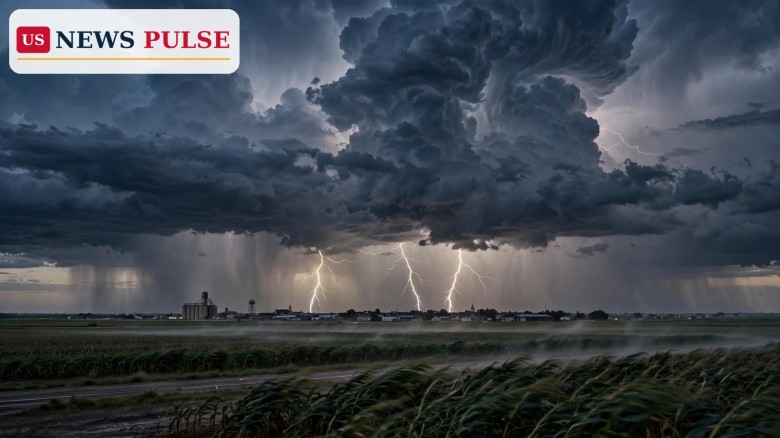
Thunderstorms across 19 states are on alert on Thursday, October 29, 2026, as the National Weather Service warns that intense thunder and lightning storms could bring heavy rain, gusty wind and large hail through the day. The warning stretches from the Southwest to the Northeast, covering much of the Plains, the Midwest, the mid-South and parts of the East — a reminder that late-October weather in the United States can still turn fast, even without a named storm on the map.
The alert landed on Thursday morning, with The Spun reporting that the National Weather Service had put 19 states on alert for potentially serious thunderstorms. The report, published at 9:09 a.m. Eastern time on October 29, said the strong storms could feature major rain and wind, large hail and more throughout the day. It did not name a single storm system as the cause, and it did not claim that every part of every listed state would see a storm. The warning is a broad, day-long alert: storms are expected to develop in different places at different times, and local offices will refine it with watches and warnings as the day goes on.
That breadth is what makes the warning unusual. The list runs from Arizona and New Mexico in the Southwest, through Texas, Oklahoma, Kansas, Nebraska, Iowa, Missouri, Louisiana, Mississippi and Tennessee, into Illinois, Indiana, Ohio, Michigan and Wisconsin in the Midwest, and on to Kentucky, Pennsylvania and New York in the East. It is not a hurricane warning, and it is not a tornado outbreak warning. It is a thunderstorm warning on a continental scale — the kind of day when millions of people, from the southern Plains to the Great Lakes and the Northeast, are told to keep an eye on the sky.
The timing matters too. The alert comes two days before Halloween, when many families will be outdoors for trick-or-treating, and days before the November 3 midterm elections, when early voters and campaign events are moving across the same states. A wet, stormy Thursday does not stop an election, but it can close roads, delay travel and force outdoor events indoors — practical disruptions that local officials watch closely on a day like this.
To understand Thursday's alerts, it helps to separate two different kinds of forecast. The National Weather Service's local alerts and the widely shared warnings reported on Thursday describe where thunderstorms are expected and what they may bring. The Storm Prediction Center, the Norman, Oklahoma, office that issues the national severe-weather outlooks, answers a narrower question: will storms meet the formal criteria for "severe" — damaging wind, large hail, or a tornado risk?
On that narrower question, the Center's Day 1 outlook for Thursday, issued at 12:52 a.m. Central time, is clear. It states that no severe thunderstorm areas are forecast, and its summary says: "Severe thunderstorms are not forecast across the U.S. today or tonight." The discussion behind that call describes a mid-level ridge becoming established in the central United States, a cold front advancing southward, and a somewhat moist air mass from the central Plains into the mid-Mississippi Valley. Thunderstorms are possible near the front over parts of the mid-Missouri Valley, and in parts of the southern Rockies and southern High Plains — but, the outlook says, instability and deep-layer shear are forecast to be relatively low, and insufficient for severe thunderstorm development.
That is not a contradiction with the 19-state warning. A thunderstorm can still be dangerous without being classified as severe: heavy rain can flood roads, gusty wind can bring down branches and power lines, large hail can damage cars and roofs, and lightning kills more people in the United States in a typical year than tornadoes do. The two forecasts are answering different questions, and the safe reading of both together is this: expect storms across a wide area on Thursday, but do not expect a severe outbreak of the kind that brings widespread tornado or destructive-wind warnings.
The pattern also fits the wider late-October picture. Earlier in the week, the Center's outlooks were already tracking a shortwave trough moving out of the Southwest and northern Mexico, a cold front progressing through the lower Great Lakes and parts of the Ohio Valley, and southerly low-level flow persisting in the southern and central Plains. Thursday's storms sit inside that unsettled pattern, rather than arriving as a single dramatic system.
In the Southwest, Arizona and New Mexico are the western edge of Thursday's alert, and the story there continues into Friday. The Storm Prediction Center's Day 2 outlook, issued at 12:16 a.m. Central time on Thursday, puts a marginal risk of severe thunderstorms across parts of Arizona on Friday, with isolated strong to severe storms possible across southern and central Arizona. Damaging wind gusts and large hail will be possible with the strongest storms there, the outlook says, as a mid- and upper-level shortwave disturbance moves through and moisture spreads into the region, with dewpoints in the 50s to low 60s Fahrenheit and modest wind shear.
Across the Plains and the mid-South — Texas, Oklahoma, Kansas, Nebraska, Iowa, Missouri, Louisiana, Mississippi and Tennessee — the main concerns are the classic thunderstorm hazards: sudden heavy rain that can flood low-lying roads and small streams, gusty wind, and hail. These are also the states where a cold front moving south can act as a trigger, lifting warm, moist air into storms along and ahead of the boundary. Drivers in this corridor should be ready for visibility to drop quickly in a downpour, and for conditions to change from one county to the next.
In the Midwest and the East — Illinois, Indiana, Ohio, Michigan, Wisconsin, Kentucky, Pennsylvania and New York — the same front is the story. Thunderstorms here may be more scattered, but they carry the same advice: when thunder roars, go indoors. Lightning can strike well ahead of the heaviest rain, and it remains the most underestimated thunderstorm danger. No place outdoors is safe when lightning is nearby — not a porch, not a tree, and not an open field.
The clearest official guidance on Thursday comes not from a single dramatic quote, but from the safety advice that accompanies the warnings themselves. The Spun's report repeats the National Weather Service's "Stay Weather Ready" message: keep listening to local news or a NOAA Weather Radio for updates on severe thunderstorm watches and warnings, and move to a secure location if a warning is issued for your area.
At home, the advice is to go to a secure interior location if a severe thunderstorm warning sounds, because damaging wind or large hail may be approaching, and to take pets inside if time allows. At work or school, stay away from windows during a warning and avoid large open rooms such as cafeterias, gymnasiums and auditoriums, where a roof is more vulnerable. Outside, go inside a sturdy building immediately if storms approach: sheds and storage facilities are not safe, and sheltering under a tree can be deadly, both because the tree may fall and because standing under it raises the risk of a lightning strike. In a vehicle, you are safer than you would be outside, but the guidance is to drive to the closest secure shelter if there is sufficient time.
The Storm Prediction Center's own wording is the most important corrective to any alarm about Thursday. Its outlook does not forecast a severe outbreak, and it does not name any risk area for the day. Readers who see the 19-state list shared on social media should check their local National Weather Service office for the watch or warning that actually applies to their county, rather than assuming the whole list means the same danger everywhere.
A 19-state thunderstorm alert matters for a simple reason: it touches so many people's ordinary plans at once. Commuters, school runs, outdoor workers, delivery drivers, sports fixtures and Halloween preparations all sit under the same sky on Thursday. Even a non-severe thunderstorm can flood a road, knock out power to a neighbourhood, delay a flight or force an outdoor event to move. Multiplied across 19 states, those small disruptions add up to a genuinely national weather day.
It also matters as a test of how weather information travels. The 19-state figure is striking, and it is easy to share without the context that the Storm Prediction Center does not expect severe storms. That context is not a reason to ignore the warning — it is the reason to read it correctly. Thunderstorms deserve respect even when they fall short of the severe threshold, and the safest response is the least dramatic one: check the local forecast, have a shelter plan, and stay indoors when storms arrive.
Finally, Thursday is a staging post for the weekend. The same unsettled pattern that brings Thursday's storms is followed, on Friday, by a marginal severe risk in Arizona, and, over Halloween weekend, by a separate western storm that forecasters say could bring mountain snow. Weather in late October rarely arrives as a single event; it arrives as a sequence, and Thursday is the first chapter of this one.
On Friday, attention shifts west. The Storm Prediction Center's Day 2 outlook keeps a marginal risk of severe thunderstorms across parts of Arizona, with the strongest storms there capable of damaging wind gusts and large hail through the early evening, particularly across southern to central Arizona. The next Day 2 outlook was scheduled for 5:30 p.m. Central time on Thursday, so that picture may be refined before Friday begins.
Over Halloween weekend, a separate storm system is expected to bring rain and mountain snow across the western United States. According to OpenSnow forecasts reported by Men's Journal on Thursday morning, the storm pattern shifts south after earlier snowfall in Washington, Idaho and Montana, and by Saturday, October 31, the Sierra Nevada and Colorado's San Juan Mountains could see additional accumulation, although warmer temperatures will keep much of the precipitation falling as rain at lower elevations. The National Weather Service in Reno anticipates cooler, unsettled conditions, with weekend snow levels generally above 6,500 feet — a split that matters for travellers, since mountain passes could see winter conditions while nearby valleys receive rain.
For Thursday itself, the advice stays the same all day: watch your local forecast, not just the national list. Watches and warnings are issued county by county, and they will tell you whether your area faces heavy rain, hail, wind or lightning — and when. If a warning is issued for your location, act on it immediately, and do not wait for the storm to look dramatic before taking shelter.
Arizona, Illinois, Indiana, Iowa, Kansas, Kentucky, Louisiana, Michigan, Mississippi, Missouri, Nebraska, New Mexico, New York, Ohio, Oklahoma, Pennsylvania, Tennessee, Texas and Wisconsin, according to The Spun's report of the National Weather Service warnings.
No. The Storm Prediction Center's Day 1 outlook for Thursday says severe thunderstorms are not forecast across the United States today or tonight. Thunderstorms can still bring heavy rain, gusty wind, large hail and dangerous lightning without meeting the formal severe criteria.
Go inside a sturdy building immediately, stay away from windows, avoid large open rooms such as gymnasiums, and do not shelter under a tree. Keep listening to local news or a NOAA Weather Radio for watches and warnings for your county.
On Friday, a marginal risk of severe thunderstorms covers parts of Arizona, with damaging wind and large hail possible in the strongest storms. Over Halloween weekend, a western storm is expected to bring rain and mountain snow to California and Colorado, with snow levels generally above 6,500 feet.
Check your local National Weather Service office and the Storm Prediction Center's outlooks, which are updated through the day. Local watches and warnings are issued county by county and are more specific than any national list.
Related coverage on US News Pulse: Halloween weather forecast 2026: rain, storms and flood risk hit Texas and the Plains, Typhoon In-Fa warning: Category 4 storm nears Northern Mariana Islands, and Western US winter storm brings up to 14 inches of snow before Halloween.
Leave a Comment



 | Today's Date: