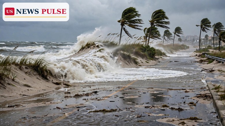
A Daytona coastal flood warning is in force across much of Florida's east coast this week, with forecasters warning that 7- to 11-foot surf, astronomically high tides and strong northeasterly winds could flood coastal roads, erode beaches and close low-lying streets through 2 a.m. on Friday, October 30, 2026. The National Weather Service issued the warning and a high surf advisory early on Tuesday, October 27, urging residents in Volusia and Flagler counties to protect property, stay out of the water and never drive through floodwater of unknown depth.
The warning began in the early hours of Tuesday. The National Weather Service office in Melbourne issued a coastal flood warning for coastal Volusia County at 2:26 a.m. Eastern Time, while the Jacksonville office issued its own warnings for Flagler and neighbouring northeast Florida counties at 3:33 a.m. The Daytona Beach News-Journal reported the alerts later on Tuesday, as residents in Daytona Beach, Ormond Beach, Palm Coast and Flagler Beach woke to rough surf and water pushing over beaches that are normally dry at high tide.
The cause is a combination of forces rather than a single storm. Strong northeasterly winds are blowing onshore, piling water against the coast, while the moon is producing astronomically high tides. The recent full moon has added to the effect, a pattern Florida sees most often in the autumn, when so-called king tides lift normal high tides well above their usual range. No hurricane or tropical storm is driving this event. Instead, persistent wind and tide are doing the damage together, day after day, which is why the warning lasts for three days rather than a few hours.
In Volusia County, the warning calls for significant coastal flooding. Surf of 7 to 11 feet will generate large breaking waves, dangerous rip currents and significant shoreline erosion, forecasters said. Coastal roads may be closed, and low-lying homes, businesses and some critical infrastructure could be inundated. In Flagler County, the warning calls for moderate coastal flooding during periods of high tide, with the same 7- to 11-foot surf, large breaking waves and a high risk of rip currents. Numerous roads could be closed there too, and localised beach erosion is expected.
Florida's east coast is no stranger to this kind of event, but the timing makes it familiar in an unwelcome way. Autumn king tides regularly push water into streets in Daytona Beach, Flagler Beach and St. Augustine, and the same stretch of coast has dealt with repeated erosion in recent years. What makes this episode different is its duration and its breadth: warnings stretch from Nassau and Duval counties in the northeast, through Flagler, Volusia, Brevard, Indian River, St. Lucie and Martin counties, and down to Palm Beach County in the southeast, where surf of 8 to 13 feet was reported in some advisories.
The wider picture also helps explain why forecasters are taking a three-day event seriously. Rainfall over the previous three days had been modest, mostly half an inch to an inch along the east coast, with 1 to 2 inches near Palm Coast, Flagler Beach, Orange City and Port St. Lucie, and 2 to 3 inches near Fort Pierce. That means this is not mainly a rain flood. It is a surge-and-tide flood, where the sea itself, driven by wind and moon, reaches places it does not normally reach. Salt water can damage cars, undermine dunes and eat away at the sand that protects coastal roads and buildings.
Similar warnings have run in parallel elsewhere in the United States this month. Hawaii faced a flood watch as the remnants of Tropical Depression Olana dragged deep tropical moisture over the islands, a story covered here, while Typhoon In-fa threatened the Northern Mariana Islands as a Category 3 storm, covered here. The Florida event is smaller in scale than either, but it affects a densely populated coastline where a few feet of extra water can close a road, flood a car park or cut off a beachfront neighbourhood.
Three different alerts are running at once, and they mean three different things. A coastal flood warning means significant flooding is occurring or imminent, and residents should be alert for rising water and take action to protect life and property. A high surf advisory means large breaking waves, in this case 7 to 11 feet in the surf zone, will cause localised beach erosion and dangerous swimming conditions. A rip current statement, or high rip current risk, means dangerous rip currents are expected, and entering the surf is strongly discouraged.
The surf forecast tells the story of the week. Meteorologist Larry Struble, of the National Weather Service in Jacksonville, put it plainly: surf heights of 7 to 10 feet on October 27, 8 to 10 feet through October 28, 6 to 8 feet on October 29 and 5 to 6 feet on October 30. Those are still high figures even on the last day, Struble noted, and they explain why the warnings do not lift until Friday morning. In Volusia County specifically, forecasters warned of surf of 7 to 11 feet, a range that covers the biggest breakers expected anywhere in the two counties.
The tide forecast matters just as much as the waves. High astronomical tides, pushed farther inland by onshore wind, are the mechanism that turns rough surf into flooding. At high tide, water that would normally stop at the beach can cross dunes, reach coastal roads and pool in low-lying streets. At low tide, the danger eases but does not disappear, because rip currents remain strong and the beach itself may have changed shape overnight as sand is stripped away.
Scott Kelly, of the National Weather Service in Melbourne, explained the tide mechanism in terms any coastal resident will recognise. "High astronomical tides caused by the moon are being pushed further into the coast, bringing the potential for beach erosion and flooding," Kelly said. The point is that the moon is not a distant cause here: it is the reason the water is higher than usual in the first place, and the wind is the reason it is being driven inland.
Struble, in Jacksonville, gave the day-by-day surf picture and a blunt warning about its persistence. "We are looking at surf heights of 7 to 10 feet today (Oct. 27), 8 to 10 feet through Oct. 28, 6 to 8 feet Oct. 29 and decreasing to 5 to 6 feet Oct. 30," he said. "But still, these are still pretty high surf." Kelly added that some waves could reach coastal dunes and, in some locations, breach them, a warning that matters for beachfront homes and for the roads that run just behind the dunes.
The official safety advice is consistent across both Weather Service offices and has not changed since the warnings were issued. Residents in low-lying and coastal areas are urged to take precautions to protect property from flooding. Beachgoers are advised to stay out of the water because of hazardous swimming and surfing conditions. Anyone who must travel should not drive around barricades or through water of unknown depth, because a flooded road can hide a washed-out surface or a current strong enough to carry a car.
This warning matters because it affects everyday life on one of America's busiest coastlines, not because it is a record-breaking storm. Daytona Beach, Palm Coast and Flagler Beach are working coastal cities, not just holiday destinations, and a three-day flood warning disrupts commutes, beach businesses, lifeguard operations and road maintenance. When a coastal road closes, the diversion is rarely short, and when sand is stripped from a beach, it does not return overnight.
It also matters as a reminder of how autumn tides work in Florida. King tides are not caused by storms, but by the alignment of the Earth, moon and sun when the moon is at perigee, its closest point to Earth, at the same time as a new or full moon. That alignment lifts tides beyond their normal range, and when strong onshore winds arrive at the same time, the result is exactly what Volusia and Flagler are seeing now: water where it does not belong, for days at a time. Understanding that mechanism helps residents judge the next warning too, because the same combination will return with the next autumn full moon.
Finally, the rip current risk deserves emphasis on its own. Rip currents can sweep even the best swimmers away from shore into deeper water, and they are most dangerous precisely when the surf looks exciting. The Weather Service advice is simple and worth repeating: remain calm, conserve energy, float or tread water if possible, do not swim against the current, swim parallel to the shoreline to escape its pull, and signal for help if you cannot reach shore. Staying out of the water in the first place is safer still.
The warnings remain in effect through 2 a.m. Eastern Time on Friday, October 30, for Volusia and Flagler counties, with the high rip current risk running through late Thursday night in east central and northeast Florida. Surf should ease gradually, from 8 to 10 feet on Wednesday to 6 to 8 feet on Thursday and 5 to 6 feet on Friday, but forecasters caution that conditions will remain hazardous until the advisory period ends.
Residents should expect the pattern seen on Tuesday to repeat at each high tide: water pushing onto beaches, possible road closures in low-lying areas, and further beach erosion. Local authorities may close coastal roads at short notice, and beachgoers should check the latest National Weather Service updates before heading to the coast. Anyone in a low-lying home or business should move vehicles and valuables to higher ground where possible, and should not wait for water to arrive before acting.
After Friday morning, the immediate threat should ease, but the clean-up will take longer. Eroded beaches need to be assessed, closed roads need to be inspected for undermining, and dunes that were breached need repair before the next high-tide cycle. Forecasters will also be watching whether the onshore wind pattern holds into the weekend, because a longer wind event could extend rough surf even after the formal warnings expire.
The coastal flood warning and high surf advisory issued early on October 27, 2026, run through 2 a.m. Eastern Time on Friday, October 30, 2026, for Volusia and Flagler counties.
Surf of 7 to 11 feet is expected in both counties, with 7 to 10 feet on October 27, 8 to 10 feet on October 28, 6 to 8 feet on October 29 and 5 to 6 feet on October 30.
Strong northeasterly winds gusting to 35 mph are pushing astronomically high tides, linked to the recent full moon, farther inland. No hurricane is driving this event; wind and tide together are causing the flooding.
No. Forecasters warn of a high risk of rip currents and dangerous swimming and surfing conditions throughout the advisory period, and advise beachgoers to stay out of the water.
Do not drive around barricades or through floodwater of unknown depth. Turn around, take another route, and remember that salt water can damage cars and that a flooded road may hide a washed-out surface.
Leave a Comment



 | Today's Date: