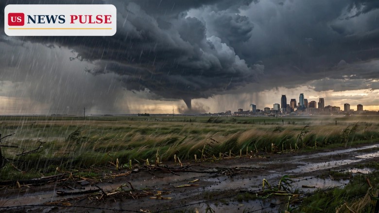
The Minneapolis tornado threat put the Twin Cities on alert on Wednesday, October 28, 2026, as forecasters warned that a rare late-October storm system could spin up strong tornadoes across eastern Minnesota and northwest Wisconsin. The Minneapolis tornado threat is centred on the late afternoon and evening, when a storm moving out of the Rockies was expected to reach the Upper Midwest, bringing with it the risk of tornadoes rated EF2 or stronger, large hail and damaging winds.
NOAA's Storm Prediction Center issued its Day 1 convective outlook at 11:20 a.m. CDT on Wednesday, October 28, 2026, warning that a few severe thunderstorms could occur over parts of Minnesota and Wisconsin that afternoon and early evening, with isolated tornadoes, severe hail and damaging winds possible. The outlook, valid from 16:30 UTC on October 28 to 12:00 UTC on October 29, put a slight risk of severe thunderstorms across parts of eastern Minnesota into northwest Wisconsin.
Forecasters described a shortwave trough over the northern High Plains late on Wednesday morning advancing east-northeast towards the Upper Midwest through the afternoon and evening. A related surface low over the central High Plains was expected to develop northeastward to south-central Minnesota by mid-afternoon, with a trailing cold front extending southwest across the northern and central Plains. That set-up, the outlook said, could support a narrow zone of severe weather with thunderstorms developing near or just east of the surface low across southern and eastern Minnesota into northwest Wisconsin.
FOX Weather reported that Minneapolis was in the bull's-eye of the threat, with the Twin Cities metro area and parts of western Wisconsin under the Level 2 risk. Its report said the strongest storms were expected in the Minneapolis area around 3 p.m. local time, and that tornado formation would depend on whether enough humidity and daytime heating developed ahead of the storm's arrival. FOX9 meteorologist Cody Matz discussed the unusual late-season threat, explaining the three ingredients severe weather needs: moisture, strong winds and warmth.
Other reporting put the tornado probability at 2 to 5 percent across the two states, with a 5 percent chance along the Minnesota-Wisconsin border and a 2 percent chance elsewhere in the region. Cities named in the threat area included Minneapolis, St. Cloud, Mankato and Rochester in Minnesota, along with western Wisconsin communities near the border.
Late-October tornadoes are unusual in Minnesota, which is one reason forecasters stressed the rarity of this set-up. The state's peak tornado season runs through spring and summer, and by late October the ingredients for severe weather — warm, humid air near the ground and strong wind shear aloft — usually no longer overlap. On this occasion, however, surface temperatures were still warming into the 60s Fahrenheit with filtered daytime heating, while strengthening low- and mid-level winds provided around 30 to 40 knots of deep-layer shear.
The limiting factor was moisture. The Storm Prediction Center noted that surface dewpoints in the warm sector were generally only in the mid to upper 50s, which would tend to hold instability to weak levels, with mixed-layer convective available potential energy generally between 500 and 1,000 joules per kilogram, perhaps locally stronger southward into Iowa ahead of the cold front. Even so, forecasters said elongated and curved low-level wind profiles could still support a risk of a couple of tornadoes with any supercells that developed.
The system arrived in a week already packed with disruptive American weather. A second winter storm had brought heavy snow to the Cascades, northern Oregon and the Inland Northwest earlier in the week, while Florida's Atlantic coast was being battered by wind, pounding surf and coastal flooding driven by a slow-moving storm near the Bahamas and high pressure over the Northeast. The Upper Midwest threat was a reminder that the same broad pattern can deliver very different hazards in different parts of the country on the same day.
The Minneapolis tornado threat rests on a classic but conditional severe-weather recipe. Warm air at the surface, a cold front sweeping in from the west, and winds that strengthen and turn with height can organise thunderstorms into rotating supercells, the storm type most capable of producing strong tornadoes. The Storm Prediction Center's outlook pointed to exactly that combination: favourable veering wind profiles with height, sufficient boundary-layer instability in a narrow zone, and a surface low tracking into south-central Minnesota.
What made the forecast uncertain was the marginal moisture and instability. Forecasters were clear that the threat would only materialise if daytime heating proved strong enough, and that neutral lapse rates and saturated low-level profiles in the region could blunt storm development. That conditional wording matters for residents: a Level 2 out of 5 risk does not guarantee tornadoes, but it does mean the atmosphere is capable of producing them, and that any storm that does form near the surface low deserves close attention.
Hourly forecasts for Minneapolis on Wednesday showed the window clearly. Conditions were mostly cloudy through the early afternoon, with scattered thunderstorms possible from around 3 p.m. CDT and heavy thunderstorms expected around 4 p.m., before storms continued into the early evening and cleared overnight. By Thursday, the forecast turned sunny and much cooler, with a high of just 13 degrees Celsius against Wednesday's 20 degrees — a sharp change that underlined how quickly the front would sweep the severe threat away.
Forecasters and local meteorologists urged people in the threat area to stay weather-aware through Wednesday evening rather than relying on a single forecast. The National Weather Service's standing tornado advice, repeated in coverage of the threat, is to keep listening to local news or a NOAA Weather Radio for watches and warnings, and to act immediately if a warning is issued.
At home, the advice is to go to a basement, a safe room, or an interior room away from windows, taking pets along if time allows. At work or school, people should follow their tornado drill and move to a designated shelter quickly and calmly, staying away from windows and avoiding large open rooms such as cafeterias, gymnasiums and auditoriums. Outside, the guidance is to seek shelter inside a sturdy building at once: sheds, storage facilities, mobile homes and tents are not safe. In a vehicle, the safest option is to drive to the closest shelter; if that is impossible, the advice is to get down in the car and cover your head, or abandon the car and seek shelter in a low-lying area such as a ditch.
The threat also carried a practical message for travellers and commuters in the Twin Cities. With the strongest storms expected during the late-afternoon commute window, drivers were urged to check conditions before setting out, to avoid driving through flooded roads or into warned storms, and to have a shelter plan if they were caught on the road.
A tornado threat in late October matters precisely because it is easy to dismiss. Residents who associate tornadoes with spring may not check forecasts in autumn, and outdoor events, school activities and evening commutes can all be under way when storms arrive. A strong tornado — EF2 or above, with winds of 111 miles per hour or more — can destroy roofs, snap trees, overturn vehicles and turn debris into projectiles, even in a region where such storms are uncommon at this time of year.
The Minneapolis threat also matters for the wider severe-weather picture. Forecasters have repeatedly warned that the ingredients for severe storms can come together outside the traditional season when warm air lingers and strong autumn systems sweep across the Plains. Each such event tests whether warning systems, local media and the public respond as quickly in October as they do in May — and this week's Upper Midwest set-up, with its narrow but real tornado window, was a case in point.
The severe threat was expected to end as the cold front pushed east overnight, with storms clearing the Twin Cities by late Wednesday evening and sunshine returning on Thursday. Forecasters will review storm reports from Wednesday evening to confirm whether any tornadoes touched down, and the National Weather Service will survey any damage to rate confirmed tornadoes on the Enhanced Fujita scale.
Attention will then turn to the next system in the pattern and to the Halloween weekend, when separate forecasts have already flagged rain, storms and flood risk across Texas and the Plains. For Minnesota and Wisconsin, the immediate task is simpler: check for any damage or downed power lines after the storms pass, report severe weather to local National Weather Service offices, and stay alert for any further watches until the front has fully cleared the region.
Yes. On Wednesday, October 28, 2026, the Storm Prediction Center warned of a slight risk of severe thunderstorms across eastern Minnesota and northwest Wisconsin, with isolated tornadoes possible in the afternoon and early evening, including around Minneapolis.
The FOX Forecast Center said some of the strongest storms were expected in the Minneapolis area around 3 p.m. local time on Wednesday, with severe weather possible through the afternoon and early evening.
Forecasters flagged a particular risk of EF2 or stronger tornadoes in the Twin Cities metro area and parts of western Wisconsin. EF2 tornadoes carry winds of 111 to 135 miles per hour and can cause considerable damage.
Alongside Minneapolis, the threat area included St. Cloud, Mankato and Rochester in Minnesota, and communities in western Wisconsin near the Minnesota border.
Go immediately to a basement, safe room or interior room away from windows. Do not shelter in a mobile home, shed or vehicle if a sturdy building is available, and keep monitoring local news or a NOAA Weather Radio for updates.
Related coverage: Western US winter storm brings up to 14 inches of snow before Halloween, Halloween weather forecast 2026: rain, storms and flood risk hit Texas and the Plains, and Santa Fe tornado: rare EF-1 storm hits New Mexico city first time in 50 years.
Sources: NOAA Storm Prediction Center Day 1 Convective Outlook, October 28, 2026; FOX Weather, October 28, 2026; The Spun, October 28, 2026; FOX9 meteorologist Cody Matz forecast discussion.
Leave a Comment



 | Today's Date: