
Hawaii Flood Watch: Olana Remnants Bring 5-8 Inches of Rain to Islands
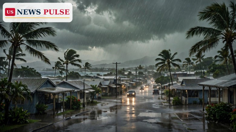
Hawaii is under a statewide Flood Watch on Tuesday, October 27, 2026, as the soggy remnants of Tropical Depression Olana drag a deep plume of tropical moisture over the islands, threatening days of heavy rain, flash flooding and mudslides. Forecasters say the heaviest rain is expected over Oahu and Maui, with 5 to 8 inches possible in the hardest-hit spots, and the greatest flood danger arriving Tuesday night and lasting through Wednesday night.
The watch runs from 6 a.m. HST Tuesday until 5 a.m. HST Thursday, according to Honolulu forecast listings, and the National Weather Service has warned that every island faces a heavy-rain threat, even though Olana itself will never reach Hawaii as a tropical cyclone. The system weakened from a tropical storm to a tropical depression on Monday and is expected to degenerate into a remnant low, but its moisture, combined with a slow-moving trough over the state, is what makes this event dangerous.
For residents and visitors, the message from forecasters is simple and urgent: never drive through flooded roads, stay away from streams and drainage channels that can rise in minutes, and be ready for the watch to be extended if the rain lingers into Thursday and Friday.
Key Points
- A statewide Flood Watch is in effect for Hawaii from Tuesday morning until Thursday morning, with the peak flood threat Tuesday night through Wednesday night.
- Tropical Depression Olana, formerly Tropical Storm Olana, has weakened to 35 mph winds and is expected to become a remnant low, but its deep tropical moisture will still soak the islands.
- Forecasters expect 5 to 8 inches of rain in the wettest areas, with Oahu and Maui County favoured for the greatest totals and a risk of mudslides in steep terrain.
- Strong or severe thunderstorms are also possible, bringing lightning, damaging wind gusts and even an isolated tornado or waterspout.
- Honolulu is forecast to see rain chances climb to 100 percent on Tuesday night and 80 percent on Wednesday, with thunderstorms expected on both days.
What Happened
Olana began life in the Central Pacific as Tropical Depression Three-C, then strengthened into a tropical storm on Sunday, October 25. By Monday it was already coming apart. The National Hurricane Center put its maximum sustained winds at just 35 mph, with gusts higher, as it drifted southeast at about 3 mph roughly 520 miles west-southwest of Johnston Island, with a central pressure of 1007 millibars.
Forecasters say hostile conditions, including increasing vertical wind shear and dry mid-level air, are tearing the system apart. The FOX Forecast Center expects Olana to become a remnant low by Wednesday morning, far from the islands, and never to make landfall in Hawaii at all.
That, however, is not the end of the story. A trough extending eastward from what is left of Olana is drifting to within about 300 miles southwest of Hawaii, while an upper-level trough more than 1,000 miles west of Kauai advances eastward. Together they are pulling a deep tropical airmass over the state, with precipitable water above 2 inches, meaning the atmosphere holds an exceptional amount of rain waiting to fall.
The National Weather Service office in Honolulu issued a Flood Watch for the entire state, and Maui Now reported on Monday that the watch runs through Thursday, October 29. A trough moving over the state, it said, should bring abundant tropical moisture and remain nearly stationary for a few days, with heavy rain and isolated thunderstorms possible across all islands.
Background and Context
Hawaii is no stranger to this kind of pattern in autumn. The islands sit in the path of Central Pacific tropical moisture, and when a trough stalls overhead, rain that would normally pass in a shower can instead fall for hours over the same mountains and valleys, turning normally dry gulches into raging streams.
This event follows a busy stretch for the state. WeatherBoy noted that Hawaii continues to recover from numerous tropical cyclone impacts in recent weeks, with systems named Lala, Lowell, Moke and Nolo bringing rain, wind and rough surf since August. Each of those systems added to saturated ground in some areas, which is one reason forecasters take even a weakening depression seriously when its moisture is aimed at the islands.
The timing also matters. The heaviest rain is not expected in a single burst on Tuesday morning, when chances of widespread rain remain relatively low, but in a prolonged, multi-day episode. The FOX Forecast Center described prolonged storms with heavy rain over two to three days, with several inches of precipitation, beginning Tuesday and fuelling a serious flash flood risk.
In Honolulu, the day-by-day picture shows how the threat builds. Tuesday brings afternoon showers and a 60 percent rain chance by day, rising to thunderstorms and a 100 percent chance at night, with about 34.5 millimetres of rain expected overnight. Wednesday stays stormy, with thunderstorms, an 80 percent rain chance and nearly 37 millimetres during the day. By Thursday the rain chances ease to 20 percent, but forecasters caution that lingering moisture could still produce heavy showers.
Hawaii Flood Watch: What the Forecast Says
The Honolulu office of the National Weather Service has been unusually specific about the sequence of this event, and its wording is worth reading closely. Early Tuesday, it says, the flood threat will be slow to build. As the day goes on, the upper-level trough edges closer, the jet stream aloft provides large-scale lift over the state, and the surface trough is pulled over the islands.
That is when the heaviest rain arrives. Computer guidance favours Oahu and Maui County for the greatest rainfall totals from this multi-day event, but the Weather Service cautions that all islands will have a heavy rain threat, and that the heaviest showers may develop in different places at different times as the trough moves.
There is also a severe-weather wrinkle. In addition to lightning, forecasters say, the storms may produce damaging wind gusts and could spawn an isolated tornado or waterspout. The greater threat, they stress, remains heavy rainfall and flooding, but residents should not ignore thunderstorm warnings if they are issued for their area.
The threat is expected to diminish Thursday and Friday as the jet stream lifts north and weak upper-level anticyclonic flow develops, ending the large-scale lift that drives the significant rainfall. Even then, the Weather Service warns, a weak surface trough and ample moisture will likely linger, providing some chance for heavy showers that could require the Flood Watch to be extended.
Reactions and Quotes
The National Weather Service in Honolulu put the timing in plain terms: "Chances for widespread rain should remain relatively low Tuesday morning as the Flood Watch goes into effect, but as moisture increases later in the day, the flood threat will slowly increase."
It added: "The flood threat will be greatest Tuesday night through Wednesday night. The jet stream aloft will provide its strongest ascent over the region, pulling the surface trough over the state and possibly generating an elongated surface low near or over the islands."
The same office has repeated the advice it gives before every Hawaii flood event: "Turn around, don't drown." Flooded roads can hide washed-out pavement and fast-moving water, and forecasters stress that flooding can be dangerous at any time, day or night.
Forecasters have also been careful to separate Olana the cyclone from Olana the moisture threat. The system itself is collapsing, they say, but the moisture tied to it is forecast to stream into Hawaii over the next several days, setting the stage for flooding conditions even though no tropical storm will strike the islands.
Why It Matters
Flash flooding is one of Hawaii's deadliest weather hazards, precisely because it can arrive so quickly in places that look safe. A stream that is ankle-deep in the morning can be chest-deep and moving fast by the afternoon, and roads through valleys and gulches can flood with little warning. Mudslides add a second danger in steep, rain-soaked terrain, where saturated soil can give way above roads and homes.
The multi-day nature of this event raises the stakes further. One heavy downpour is a problem; two or three days of repeated downpours over the same watersheds is a much bigger one, because the ground becomes saturated, streams stay high, and each new band of rain has nowhere to go but downhill. That is why forecasters are emphasising totals of 5 to 8 inches rather than a single day's rainfall.
There is also a practical impact for travel and daily life. Heavy rain and thunderstorms can disrupt flights, close roads, delay school and work travel, and knock out power in localised areas. Visitors planning hikes, beach days or drives across the islands this week should check forecasts and road conditions before setting out, and be prepared to change plans at short notice.
Finally, this event is a reminder that a storm does not need to make landfall to be dangerous. Olana's centre will dissipate far from Hawaii, yet its moisture, steered by troughs and the jet stream, is enough to put an entire state under a Flood Watch. In the Central Pacific, forecasters say, it is often the moisture, not the wind, that causes the most damage.
What Happens Next
The next 48 hours will decide how serious this event becomes. Tuesday night through Wednesday night is the window forecasters are watching most closely, when the jet stream provides its strongest lift and the surface trough sits over the state. If heavy bands stall over Oahu or Maui County, flash flood warnings, which are more urgent than a watch, could follow for individual areas.
By Thursday, the pattern should begin to break down as the jet stream lifts north. Rain chances in Honolulu fall sharply, and the large-scale lift that drives the heaviest rain eases. Forecasters have not ruled out an extension of the Flood Watch, however, if lingering moisture keeps producing heavy showers.
Residents should monitor updates from the National Weather Service Honolulu office and local county emergency agencies, keep phones charged, avoid driving through flooded roads, and never cross a flooded stream on foot or in a vehicle. Anyone in a flood-prone area should know their evacuation route and be ready to move to higher ground if water rises.
US News Pulse will continue to follow the Hawaii flood threat through the week, with updates if flash flood warnings are issued or if the watch is extended.
Frequently Asked Questions
Is Tropical Storm Olana going to hit Hawaii?
No. Olana weakened to a tropical depression with 35 mph winds and is expected to become a remnant low by Wednesday, never reaching Hawaii as a tropical cyclone. The danger comes from its deep tropical moisture, which will stream over the islands Tuesday through Thursday.
How long is the Hawaii Flood Watch in effect?
The statewide Flood Watch runs from 6 a.m. HST Tuesday, October 27, until 5 a.m. HST Thursday, October 29, according to Honolulu listings, though forecasters say it could be extended if heavy showers linger.
How much rain could Hawaii get?
Forecasters expect 5 to 8 inches of rain in the wettest areas, with Oahu and Maui County favoured for the greatest totals. Honolulu alone is forecast to see more than 70 millimetres across Tuesday night and Wednesday, with higher amounts possible in mountain areas.
Which islands are most at risk?
All islands face a heavy-rain threat, but the latest guidance favours Oahu and Maui County for the greatest rainfall. Flash flooding and mudslides are possible anywhere, especially in steep terrain and near streams and gulches.
What should I do if I encounter a flooded road in Hawaii?
Turn around and do not drive through it. The National Weather Service's advice is "Turn around, don't drown," because flooded roads can hide washed-out pavement and fast-moving water that can sweep a vehicle away.
Related coverage on US News Pulse: King tides flood US coasts with record high tides in Florida and California; Fed rate decision October 2026: why a pause looks likely despite high inflation; Supreme Court SNAP payments block extended as shutdown deal heads to House vote.
© 2026 US News Pulse. All rights reserved.
 Print
 Save