
Phoenix Halloween Rain Forecast: First Wet October 31 in Nearly 40 Years
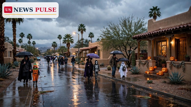
The Phoenix Halloween rain forecast has turned a desert city's driest holiday into its wettest talking point in a generation: after decades of dry, warm Halloweens, forecasters say Phoenix is in line for rain across Halloween weekend, with two separate storm systems, a Flood Watch for Friday and the prospect of the Valley's first measurable rain on October 31 itself in nearly 40 years. For trick-or-treaters who have grown up expecting sunshine and temperatures in the 80s, this year brings umbrellas, light jackets and a Saturday evening that could turn wet just as costumes hit the streets.
Key Points
- The Phoenix Halloween rain forecast points to two storm systems: a first soaking on Friday, October 30, and a second, longer spell of rain late Saturday into Sunday, November 1.
- A Flood Watch is in effect for parts of south-central and eastern Arizona from 6:00 a.m. to 6:00 p.m. MST on Friday, with the Weather Prediction Center flagging a slight risk of excessive rainfall across central Arizona.
- Forecasts put Friday's Phoenix-area rainfall at roughly a quarter to three-quarters of an inch, with higher totals in the mountains and a second round adding another half-inch to an inch in lower elevations on Sunday.
- Saturday itself — Halloween — is expected to be mostly cloudy and calmer in the middle of the day, with the best rain chances returning in the evening and overnight, so early trick-or-treating looks drier than late-night parties.
- Temperatures will feel very different from a typical Phoenix Halloween: highs fall from the mid-80s into the low 70s on Friday and Saturday, and into the upper 60s on Sunday, with overnight lows in the mid-60s.
What Happened
The change begins on Thursday night. Forecasters at the National Weather Service office in Phoenix describe dry, settled weather through midweek giving way to an unsettled pattern late in the week that persists through the weekend, with much cooler temperatures and widespread rainfall. Moisture streams in ahead of a deep trough parked off the California coast, and by Friday morning the atmosphere over south-central Arizona will be carrying more than double its normal water content, according to the service's forecast discussion.
That first system is the soaker. Showers are expected to blossom on Thursday night or Friday morning and last through much of Friday, with isolated to scattered weak thunderstorms mixed in. The storms are not expected to be severe — forecasters note modest energy and low wind shear — but, as local forecasters put it, they do not need to be: the rain itself is the story. The Weather Service puts Friday's rainfall at about a half-inch across the Phoenix area and three-quarters of an inch to a full inch in the higher terrain north of the city, while some guidance runs at least double that, which is why minor flooding is already being flagged.
The current outlook for Phoenix itself, updated on Thursday, October 29, underlines the scale of the shift. Thursday is mostly cloudy with a high near 29 degrees Celsius (84 Fahrenheit) and thunderstorms possible late at night. Friday turns to thunderstorms with a high of just 21 degrees Celsius (70 Fahrenheit) and a 90 percent chance of rain. Saturday's daytime hours are cloudy with a high of 25 degrees Celsius (77 Fahrenheit) and only a 20 percent rain chance, but Saturday night brings rain back with a 90 percent chance. Sunday is the wettest day of all in that outlook, with rain at a 100 percent chance and a high of only 20 degrees Celsius (68 Fahrenheit). By Monday, November 2, the pattern clears to partly cloudy skies.
Background/Context
Phoenix and Halloween have rarely mixed with rain. In the past decade, Halloween temperatures in the city have mostly been in the 80s, which is near average for late October in the desert, and the holiday has been a reliably dry, warm evening for outdoor events. That is what makes this weekend stand out: reports this week describe it as the first time Phoenix could record measurable rain on Halloween in about four decades.
The exact year in that record is worth stating carefully, because the reports differ slightly. The Spun, reporting on October 29, says it will be the first time Phoenix has had measurable rain on Halloween since 1987 — 40 years ago — and quotes the forecaster Max Velocity warning: “Phoenix hasn't had measurable rain on Halloween since 1987… and this year, trick-or-treaters might need an UMBRELLA!” The Arizona Republic's azcentral forecast, published October 28, phrases it differently, saying there has not been measurable rain during a Phoenix Halloween since 1988. The two framings point to the same conclusion — no wet Halloween in the Valley for roughly a generation — even if the bookkeeping of the last one differs by a year, likely down to how the Halloween-day window is counted. Either way, a rainy October 31 would break a streak older than most of this year's trick-or-treaters.
The wider pattern helps explain why. The 2026 season has already been shaped by a strong El Niño, which has boosted wind shear over the Atlantic and kept that ocean unusually quiet, while Pacific moisture has repeatedly been drawn northward. For this weekend, forecasters cite remnants of tropical moisture and a strong El Niño pattern as the main moisture sources that a West Coast trough will tap, feeding showers and scattered thunderstorms across central and southern Arizona. Earlier in the same week, heavy rain produced flooding, evacuations and water rescues in the Four Corners region, a reminder that desert ground does not absorb a sudden soaking the way wetter climates do.
Phoenix Halloween Rain Forecast: The Weekend, Day by Day
Friday, October 30, is the first rainfall event. The rain is expected to spread from southwest to northeast, beginning sometime in the morning and spreading across the Valley heading into lunchtime, falling as showers and isolated storms rather than the severe weather that poured over Arizona last week. Rainfall totals could range between 0.25 and 0.75 of an inch, with the upper-level winds pushing moisture in from the south, so the highest totals are expected in lower elevations of Arizona between Phoenix and Tucson. Because the rain will be consistent through the middle of the day, the Weather Prediction Center has most of central Arizona marked for a slight chance of flooding, meaning scattered flash floods are possible, particularly in low-lying areas and near normally dry washes.
Saturday, October 31 — Halloween itself — is the dry window between the two systems, but it is not a guarantee of a dry night. By Friday evening the widespread rain is expected to fade and back off to the east overnight, and the middle of Saturday should remain calm, though mostly cloudy. Light rain chances could reappear by the evening, and forecasters advise having a light jacket on deck for trick-or-treating and Halloween parties, since the pre-midnight hours are most likely in the clear while late-night partygoers have the higher likelihood of catching stray storms that appear ahead of the main second system.
Sunday, November 1, is meant to be the greater rainfall day. While Friday's moisture is more tropical, coming from leftover moisture hanging around the Gulf of California, Sunday's moisture comes from a modest atmospheric river, with a trough bringing uplift and moisture from the southwest. The heaviest rainfall totals are expected along the Mogollon Rim and in southeastern Arizona, where higher elevations could add another 2 inches of precipitation while lower elevations see an additional half-inch to an inch, with locally higher totals possible where thunderstorms develop. With the two rainfall events so close together, the extra rain could lead to localized flooding in low-lying areas, and forecasters warn that Sunday's rain could compound problems from Friday, especially in terrain northeast of Phoenix where air rising over slopes can enhance precipitation.
Reactions/Quotes
“Phoenix hasn't had measurable rain on Halloween since 1987… and this year, trick-or-treaters might need an UMBRELLA!” warned forecaster Max Velocity, in a post highlighted by The Spun on October 29.
The National Weather Service in Phoenix, in its forecast discussion, described the unsettled pattern arriving “late in the week and persist through this weekend” — with much cooler temperatures and chances for widespread rainfall, and embedded thunderstorms capable of heavier rain that could lead to localized flash flooding on Friday and again on Sunday.
Local forecasters at azcentral summed up the practical message for families: “Having a light jacket on deck for trick-or-treating and Halloween parties would be a good idea, but these pre-midnight times are most likely in the clear. The late-night partygoers have the higher likelihood of catching stray storms.”
The same forecast added a reassuring note for anyone fearing a washout: even if a few drops fall on Halloween itself, “it shouldn't be a washout by any means,” with the heaviest rain falling on Friday and Sunday rather than during Saturday evening's main trick-or-treat hours.
Why It Matters
For Phoenix, a rainy Halloween weekend matters for reasons that go beyond costumes. Desert cities are built for heat, not for sustained rain: drainage channels and washes that sit dry for months can fill fast, and drivers who rarely meet standing water are more likely to misjudge a flooded road. That is why a Flood Watch and a slight risk of excessive rainfall, even without severe thunderstorms, are taken seriously here — a half-inch to an inch of rain, repeated twice in three days, is enough to cause localized flooding, travel disruption and dangerous low-water crossings.
It also matters as a public-safety weekend. Halloween is one of the busiest pedestrian nights of the year, with children crossing streets in dark costumes after sunset — Phoenix sunset on Saturday is 5:36 p.m. MST — and wet roads, reduced visibility and distracted driving raise the risk. Cooler temperatures, while welcome after a summer in which Maricopa County heat deaths surged past the 2025 total, bring their own hazard: families heading out in thin costumes may be caught by a cold, wet evening if they plan only for the usual 80-degree Halloween.
And it matters because the pattern is not confined to Phoenix. The same week has brought severe thunderstorm alerts to 19 states, a reminder that late-October weather in 2026 has been unusually active coast to coast. For Arizona, the weekend is a test of how quickly a desert state can pivot from heat warnings to flood awareness — and a preview, forecasters say, of a wetter, cooler start to November, with rain lingering into Sunday night before clarity returns on Monday.
What Happens Next
The immediate question is timing. Forecasters stress that confidence is limited on exact timing and totals, especially for the second system, so residents should monitor updates through the weekend rather than treating any single forecast as final. If the first system arrives on schedule Friday morning, the Flood Watch will be the first real test; if it under-delivers, Saturday evening could stay drier for longer. If it over-delivers, low-lying areas and washes could flood before the second system even arrives.
After Sunday, the outlook clears quickly. Monday, November 2, is forecast to be partly cloudy with a high of 23 degrees Celsius (73 Fahrenheit) and only a 20 percent rain chance, and Tuesday, November 3 — midterm election day — is sunny with a high of 25 degrees Celsius (77 Fahrenheit). That clearing matters for voters as well as for Halloween clean-up: a dry election day after a wet weekend would be a relief for polling places across the Valley.
For now, the advice from forecasters is simple and practical: keep an umbrella and a light jacket within reach, plan trick-or-treating for the earlier, calmer part of Saturday evening, avoid flooded washes and low-water crossings, and check the latest National Weather Service updates before heading out — because in Phoenix, a Halloween forecast like this one has not been needed in nearly 40 years.
Frequently Asked Questions
Will it rain in Phoenix on Halloween 2026? Rain is possible on Saturday, October 31, especially in the evening and overnight, but the middle of Saturday is expected to be mostly cloudy and calmer, with the heaviest rain falling on Friday, October 30, and Sunday, November 1. Early trick-or-treating looks drier than late-night plans.
When was the last rainy Halloween in Phoenix? Reports describe it as the first measurable Halloween rain in nearly 40 years. The Spun puts the last one in 1987, while azcentral says there has been no measurable rain during a Phoenix Halloween since 1988 — a one-year difference in how the record is counted, but the same roughly four-decade streak.
Is there a Flood Watch for Phoenix this weekend? Yes — a Flood Watch is in effect for parts of south-central and eastern Arizona from 6:00 a.m. to 6:00 p.m. MST on Friday, October 30, with a slight risk of excessive rainfall across central Arizona and scattered flash flooding possible.
How much rain will Phoenix get? Friday totals of 0.25 to 0.75 of an inch are expected in the Valley, with higher totals in the mountains; Sunday could add another half-inch to an inch in lower elevations and up to 2 inches in higher elevations along the Mogollon Rim, with locally higher totals in thunderstorms.
What should trick-or-treaters do? Bring a light jacket and an umbrella, aim for earlier in the evening, stay visible on wet roads, avoid flooded washes and low-water crossings, and check the latest National Weather Service forecast before going out.
Related coverage on US News Pulse: Thunderstorms hit 19 states as NWS warns of heavy rain, wind and hail; Phoenix heat deaths surge past the 2025 total; White House Halloween: Trump and Melania host South Lawn trick-or-treat.
Sources: National Weather Service Phoenix forecast discussions, October 28-29, 2026; The Spun, October 29, 2026; azcentral, October 28, 2026; Bazaar Daily News America, October 28, 2026; Particle News, October 27, 2026; weather.com Phoenix forecast, October 29, 2026.
© 2026 US News Pulse. All rights reserved.
 Print
 Save